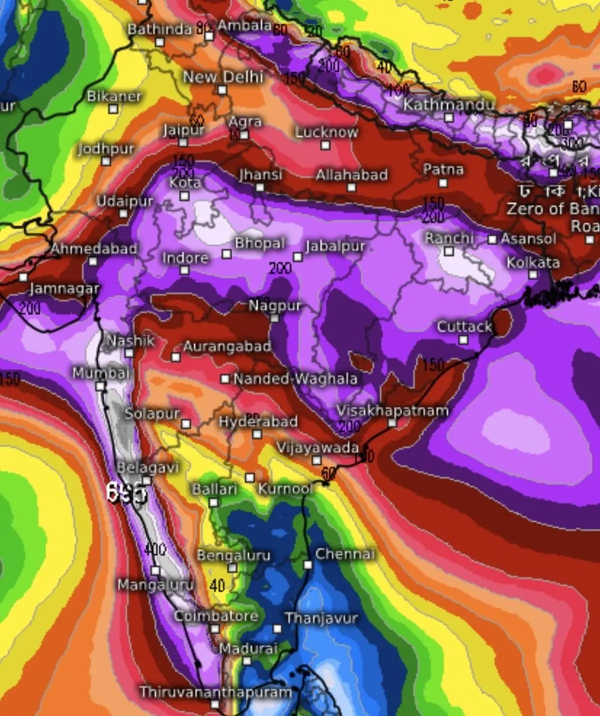
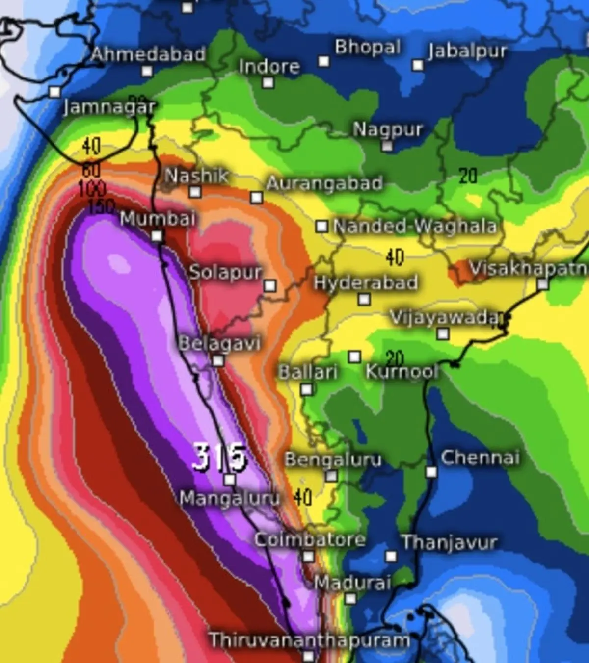
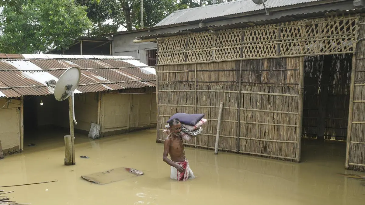
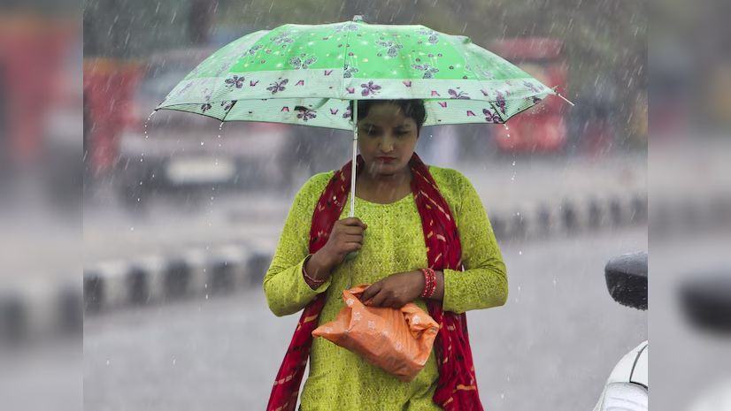
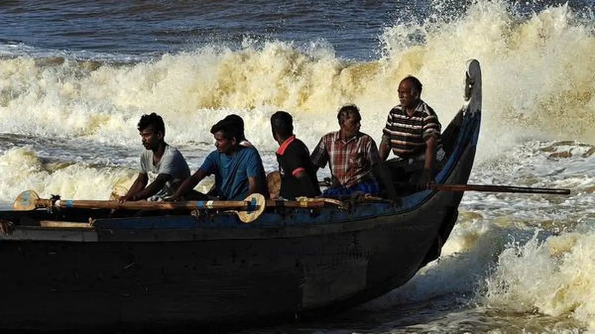
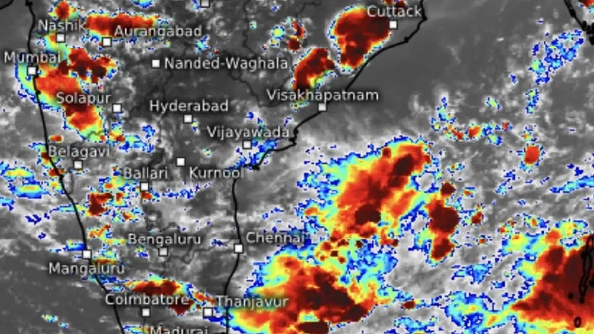
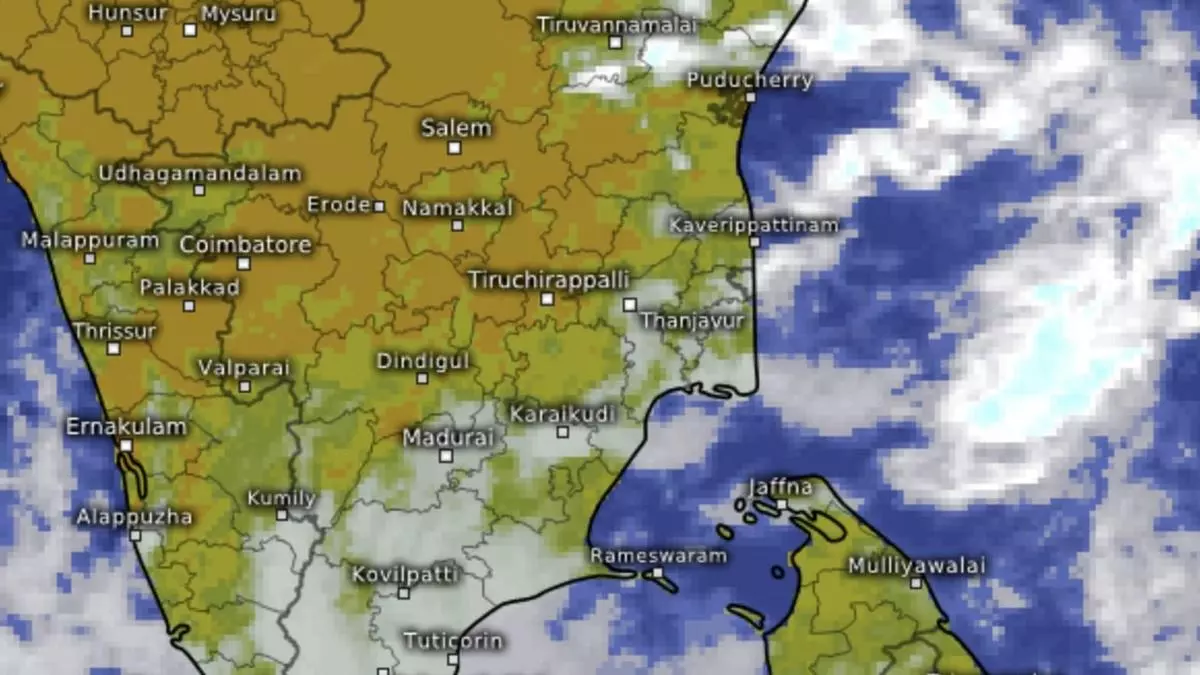
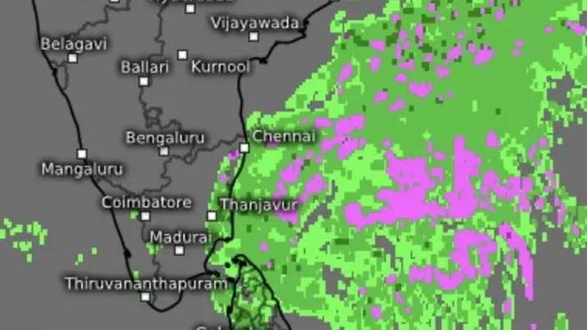
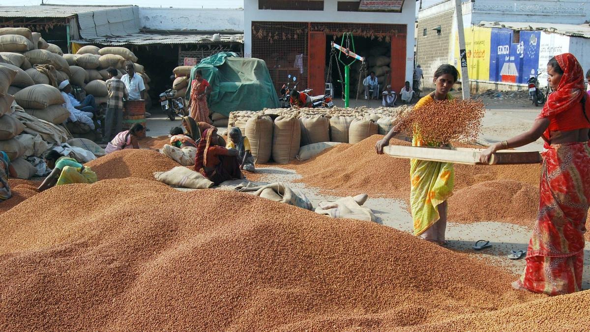
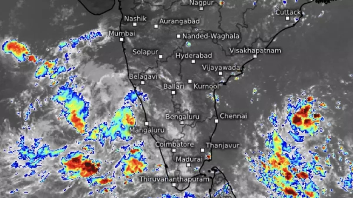
Hefty rain is likely over Coastal Karnataka on Tuesday and fairly widespread to widespread moderate rainfall, thunderstorms, lightning, and gusty winds over Kerala, Mahe, Lakshadweep, Karnataka for the next seven days as the south-west monsoon closed in for onset along what is considered a familiar territory.
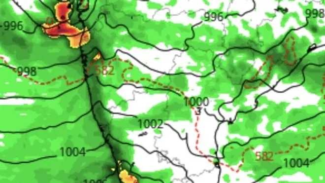
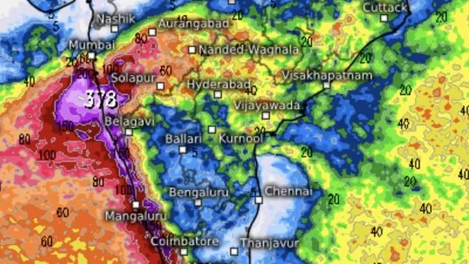
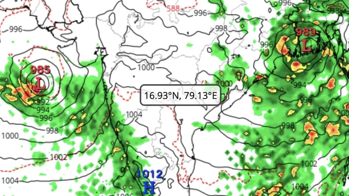
Latest numerical predictions suggest a prevailing circulation off Coastal Andhra Pradesh (Bay of Bengal) may cross the peninsula and merge with the one off Karnataka coast before the combined entity sets up the low-pressure area. The ‘low’ may track towards Konkan-Mumbai-south Gujarat and step out into the northeast Arabian Sea off south Gujarat, where it may intensify by May 28.
The monsoon will hold strong for as many days, and its further prospects would depend on whether the Bay would crank up its own circulation to anchor the flows on the other side of the peninsula and redirect monsoon to Central India. There are indications a trough, if not a closed circulation, may form off Andhra Pradesh-Odisha coasts and adjoining hinterland.